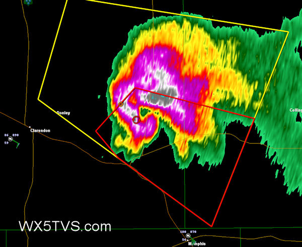
So earlier today I looked at things, though the potential was at least a little better than yesterday for a supercell in the SE TX Panhandle, but elected to save the gas and stay home and get some much needed work done on some other paying projects. Believe it or not, my target WAS actually Clarendon, because of a NW to SE boundary across there and the more backed surface winds.
A little later, some stuff started popping up around home area, and I decided the decision was a good once, because I might have to go out and chase for the TV Station. Turned out to be nothing but summer thundershowers, which had the nice effect of cooling it off here at my home, down now to 92F from 104F earlier!
Meanwhile, I am watching the big honkin’ supercell up by Clarendon with a wicked hook on it (in the radar image above), probably dropped at least one tornado already and appears to be cycling…and I would have been there. 🙁 I know Steve went NE, I hope maybe Jason is on the storm so I can at least see some pics later. If you are Jason, when you read this…you need a streaming cam man!
Meanwhile I sit and watch and listen to the fire department run on lightning started grass fires in the area. *sigh*

Well crap, I had to work! I guess nobody was on that thing today. I sure wish someone was so we could see some photos of that supercell. I put in to try to get today off (6/16/08). Maybe we can go for a repeat on yesterday and get another cell to go bonkers. Well see…
Storm survey.
http://www.srh.noaa.gov/docs/s.....mat=PRETTY