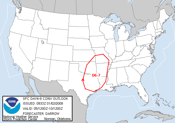
What looks to be the first good severe weather event in 2008 is shaping up in the long range guidance models. The GFS has been fairly consistent with a decent trof coming out next week into the plains and beyond with the Gulf of Mexico open for business ahead of it. Looks like a good early spring setup actually. It’s been consistent with this for several runs now with the scenario, if not in temporal terms.
Too far out to get in to too many details, as with systems this early it could all go to seed by the time the actual days get here. Looks like one of the setups where a good storm system starts in the eastern plains and then rakes through Arkansas and the southern U.S. dropping tornadoes all over the place.
But hey, it’s only the 2nd week of January. It’s good to see potential on the map this early. For me here in west Texas as least, looks like it might finally be warming up. A mesonet station not far from me recorded a low of 4F last night. That is damn cold for west Texas!