After the disgust in the total flop of severe weather potential last weekend, I have been more concentrating on getting some work done and trying to ignore the weather for a while. Until last night, I was outside taking a break and noticed one heck of a nice looking storm up north and had to go check radar. I was thoroughly disgusted. How did this happen, and more importantly, why the heck did I miss it? This was THREE counties away from me!
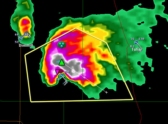
Seems the little “weak” shortwave that came over the area that was supposed to “maybe” produce some showers turned out to be a little more potent than forecast. Combine with some decent wind shear and this little puppy popped out. As far as I know, there were no tornadoes sighted, at least there are no reports. But don’t you just know that had one wicked rotating wall cloud under it. That TVS marker was present for a LONG time on that storm. To be honest, I am a bit surprised the NWS didn’t pull the trigger on a doppler indicated possible tornado with that storm. At any rate, it did get some 2.75 inch hail reported on it, and a patrol car got its windows blown out. No doubt would have been a sweet storm to chase!
So of course with all that excitement, and seeing some talk on StormTrack about this upcoming weekends potential, the call of the wild just got too strong for me and I had to take a look at some models. From what I have read, the models have been fairly consistent with one another about this scenario, although it might have slowed down a bit, making the better day Sunday instead of Saturday.
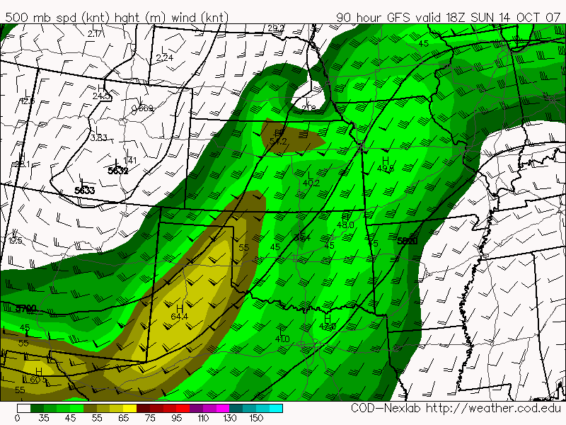
So hear we have some NICE winds out of the southwest at 500 millibars, or up in the mid levels for the average reader here, that are taking a good 60-65 knot shot at the eastern Texas panhandle. This is forecast for 18z which is 1 pm here on the southern plains. It gets even better 6 hours later!
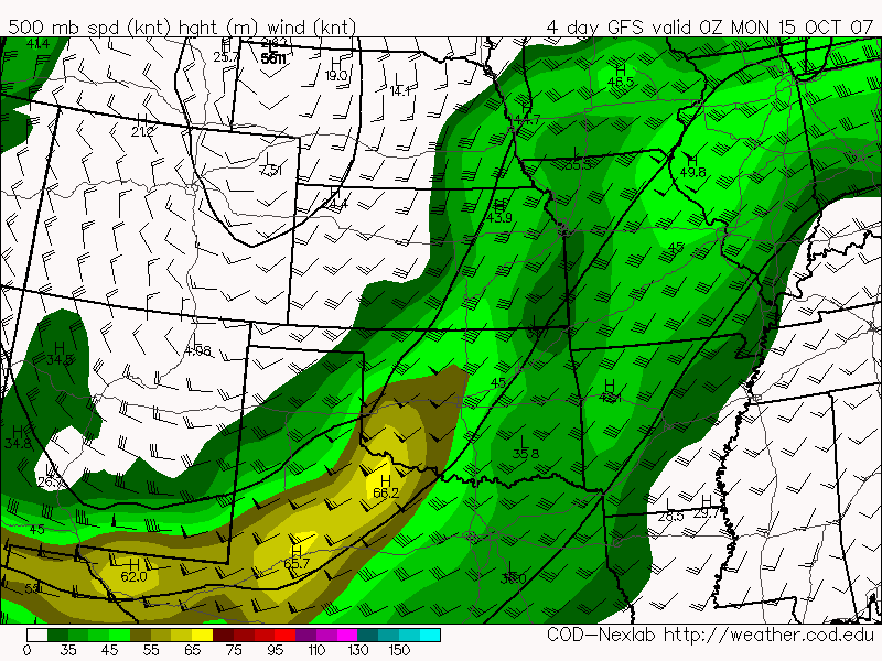
This kicks it up just a notch aimed right at the areas from about Childress, TX down to Wichita Falls.
A little closer to the surface at 850 millibars we have a very nice low level jet (LLJ) streaming moisture from the Gulf of Mexico in to this area, helping prime the atmosphere.
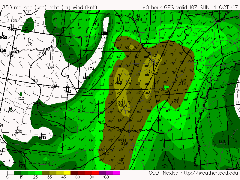
The combination of these two wind fields should yield sufficient shear to get those storm updrafts rotating pretty good. It’s not an end of the world scenario, but it could make for some great chasing, especially here in OCTOBER!
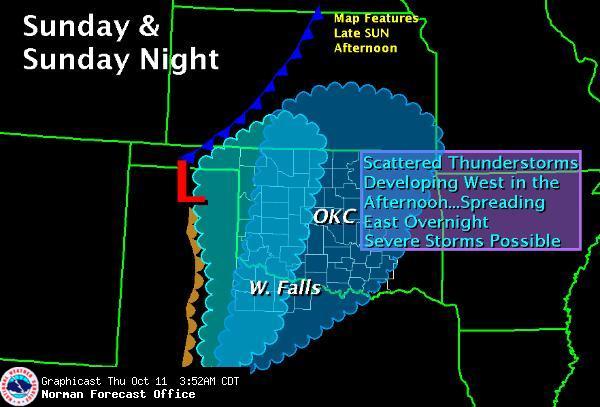
All of this is complimented by a surface low pressure that is expected to be in SW KS early afternoon and move down in to the NE TX Panhandle my early evening, trailing a dryline south from it. Looks like we will see sufficient moisture across the area with dewpoints forecast in the low 60s ahead of the dryline and some hinting at a dryline bulge in the Childress area. Afternoon temps expected in the mid 80s. Right now models I believe are underforecasting the CAPES in this area, given the forecast temps and dewpoint, assuming they verify.
Probably getting a little to detailed now this far out really, but the setup looks darn good for some severe weather from about the eastern Oklahoma Panhandle, down through the eastern Texas Panhandle and maybe as far south as Big Spring, TX and points east from there of course as the evening goes on.
I’ll do an updated forecast on this on Saturday. Everyone of course is welcome to input their take on the situation in the comments!
Leave a Reply