WOW! Describes what happened last evening perfectly. The first severe weather event of the year turned out to be a grand one indeed. If this is a sign of things to come, it’s going to be one heck of a year for storm chasing. Some storm chasers banked their first tornado catches of the year last evening, on January 8…. amazing!
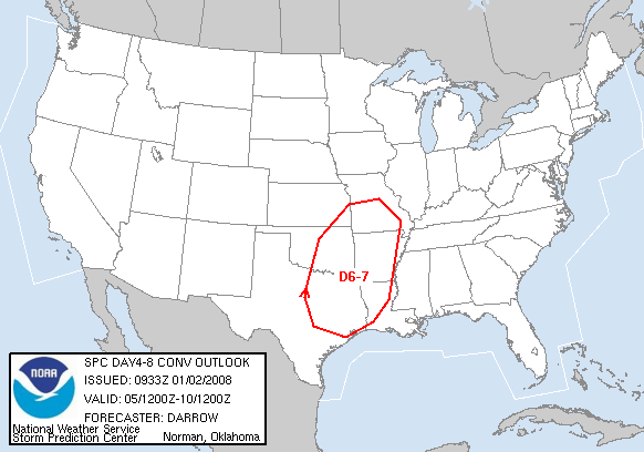
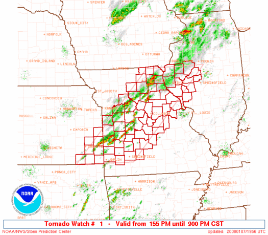
Before the night was over we had 7 tornado watches, including one PDS watch (Particularly Dangerous Situation) stretching from Oklahoma to the Great Lakes region in and even that is STILL ongoing as I write this with a tornado watch up from Louisiana to Indiana.

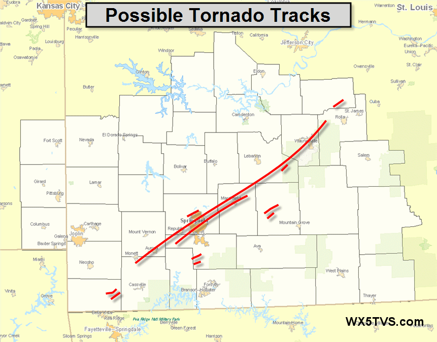
The bulk of the tornadic activity took place in the PDS watch box across southern Missouri, in and around the Springfield area. At one point we had tornado warnings stretching across the entire state! In this area supercell after supercell trained across the Springfield area SW to NE, all being tornadic and dropping numerous tornadoes. Unfortunately, there was quite a bit of damage and a couple of fatalities as well.
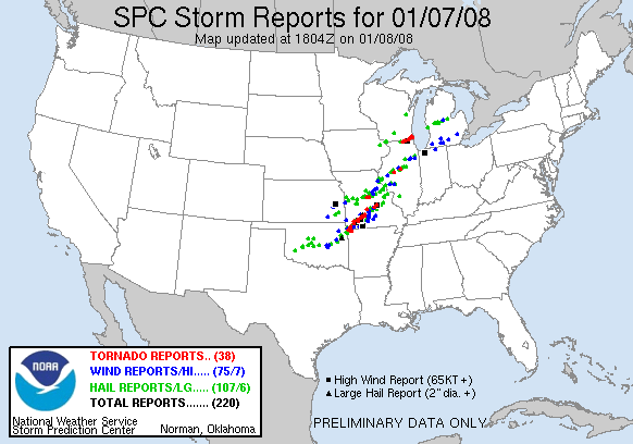
By 6 p.m. Central Time, the Storm Prediction Center showed 38 reports of tornadoes, with another 5 reports since that time. It is still unconfirmed the exact number of tornadoes as of this writing. It may be days before all the NWS offices can get their surveys and reports done.
I of course was not chasing this event, as I generally won’t go more than 150 miles from home before April 1st (after big busts in previous years on long, early season trips). A number of chasers did get out yesterday and some of them were able to capture a tornado.


The above two images I captured on GRL3 radar software as one of the supercells was approaching Springfield with a tornado on the ground that had just caused damage in Strafford. One picture I noted below is destined to be a classic!
Here is the preliminary tornado tracks report from the NWS in Springfield, Missouri.
Not to forget the folks up further north in Wisconsin and Illinois where even more tornadoes caused damage and several communities.
I’ve also added some video to the front page of the website from the events.