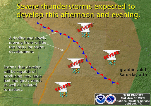
A potent June setup for severe weather is underway across the Texas Panhandle and South Plains today. Very high instability will be in place by late afternoon, as well as an old frontal boundary and a dryline with a triple point intersection setting up around southwest Swisher or perhaps northern Hale County. Wind shear throughout the atmosphere levels is more than sufficient for supercell formation, even though we are lacking a more potent upper air setup, the extreme instabilites with CAPEs approaching 5000 this afternoon should make up for it.
Right now it looks like isolated supercells across the entire area east of the dryline are a definite possiblity, and with them winds possibly exceeding 80mph, hail larger than baseballs, and even tornadoes on or near the previously mentioned frontal boundary. Any storm that can latch on and ride down that boundary could be cyclic and produce repeated tornadoes. In my opinion, the greatest risk for that happening right now is in Swisher, Hale, Floyd and Crosby counties, although risk is there for that anywhere a county either side of those counties, as well as any supercell could produce a tornado today.
I’ll be heading out here shortly for an initial target of Plainview, TX and adjust later as needed. I will of course be streaming live again both on the internet on my site here on the LIVE ChaseCam page and you can watch the coverage on KCBD 11.1 over the air. If you live in the area, be sure to tune in to keep on top of the developing weather situation today, as well as have your weather radios on!