Yet another major winter storm has taken aim on the lower end of the Great Plains this weekend, hopefully this will be our last one and spring will fully kick in!
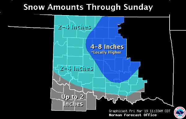
This one is promising some impressive snow totals, as much as 8″ in Oklahoma, perhaps even more! This could be crippling for the Oklahoma City metro area.
Already Winter Storm Watches and Warnings as well as Winter Storm Advisories are up across all of Northwest Texas, the eastern half of New Mexico, and most of Oklahoma and Kansas!
Light snow is already falling in some locations and blizzard conditions will exist in some places. Some locations will most likely set new records for total winter snowfall during this event!
Below are images from the National Weather Service Forecast Offices in Lubbock and Amarillo, TX as well as Norman, OK depicting the current forecast totals.
Now is the time to take your winter weather preparations and safety precautions.


