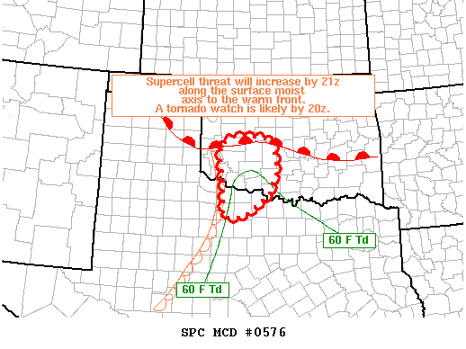
PARTICULARLY DANGEROUS SITUATION
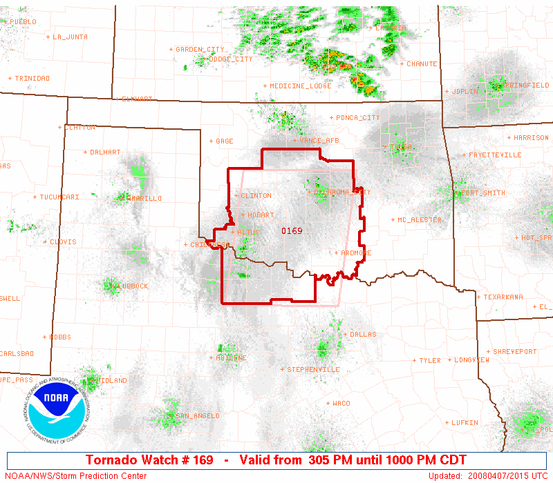
SPC has issued a PDS Tornado Watch at this time. I gotta grab a bite to eat real quick and get moving, so I’ll just post the important text from the watch. They have also upgraded the risk today to MODERATE. It smells like tornadoes outside. I know that sounds weird, but after all these years chasing on the plains, tornado days just have a certain smell to them.
ChaseCAM is now LIVE!
DISCUSSION...A VERY POTENT SUPERCELL ENVIRONMENT IS DEVELOPING
   ACROSS THE WATCH AREA THIS AFTERNOON.  STRONG VEERING SHEAR PROFILES
   COUPLED WITH AN INCREASINGLY UNSTABLE AIR MASS WILL SUPPORT
   DEVELOPMENT OF SEVERE THUNDERSTORMS BOTH VICINITY E/W FRONTAL ZONE
   CENTRAL OK AND ALONG AND E OF DRY LINE EXTENDING SWD INTO NWRN TX.
   SUPERCELLS WILL RAPIDLY EVOLVE GIVEN SHEAR WITH ASSOCIATED VERY
   LARGE HAIL AND TORNADO THREAT WITH ANY STORM.  POTENTIAL EXITS FOR
   LONG LIVED SUPERCELLS MOVING ACROSS WARM SECTOR WITH POSSIBLE STRONG
   TORNADOES.