Little time to put my forecast here today as I got in late last night to the motel in Childress, TX and got up late today, so I’ve been rushing to get ready to chase. Update on yesterday coming later, but we got 1 weak tornado at close range and on incredible rotating wall cloud I can’t believe didn’t produce a large tornado.
Turning attention to today…
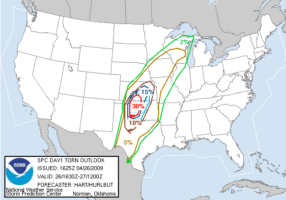
The Storm Prediction Center has issued a high risk for severe weather today for a large part of the southern/central plains. Risks include potential for widespread supercells with significant tornadoes and some giant hail. In some ways, this reminds me of an event 10 years ago that produced a historical tornado outbreak. This is the greatest risk for tornadoes today:
Since I don’t have time for a detailed forecast, I will refer you readers to the public severe weather outlook. If you reside in or near these areas you might want to think about canceling any outdoor activities you have planned for today, and at the very least pay extremely close attention to media sources and your weather radio for developing severe weather. Things will develop and get intense quickly.
I should be streaming live on the LIVE ChaseCam page here shortly.


Leave a Reply